出典: フリー百科事典『ウィキペディア(Wikipedia)』
[編集]  ウィキメディア・コモンズの記述
[edit] Summary
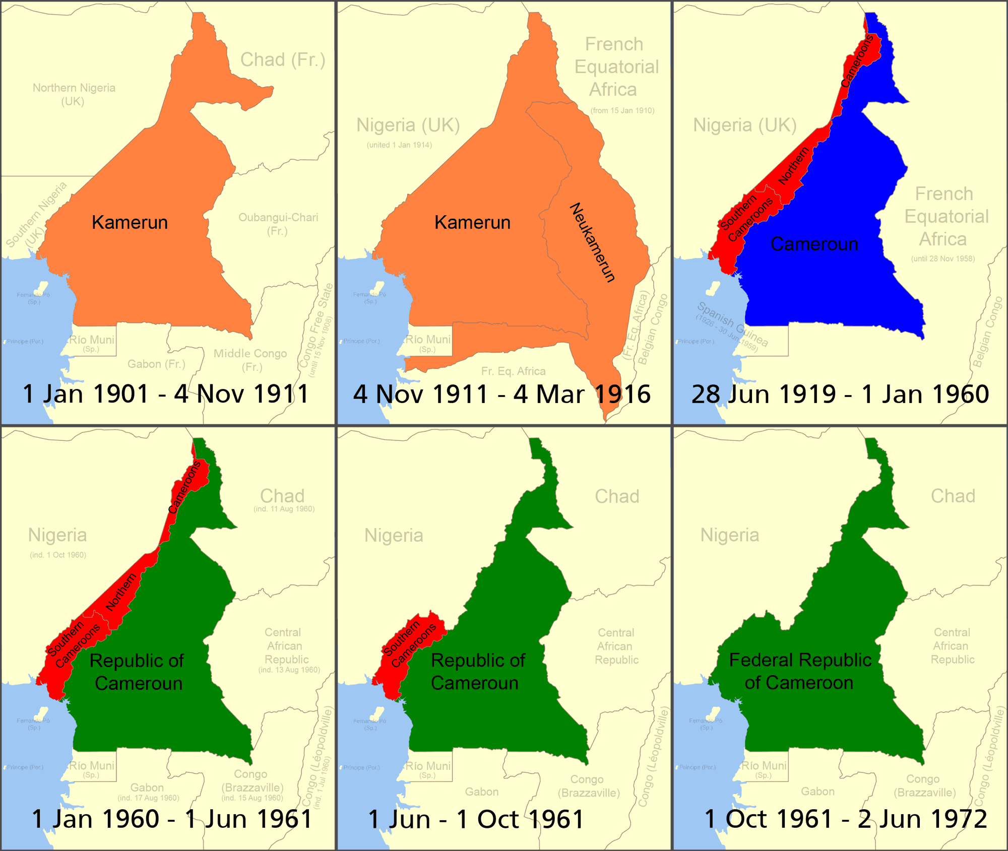
Boundary changes in w:Cameroon.
- Orange = German colony of Kamerun (given more territory by the French in 1911 following the w:Agadir Crisis)
- Red = British w:Cameroons after WWI (divided into separate Northern Cameroons and Southern Cameroons)
- Blue = French Cameroun after WWI
- Green = Independent Cameroon ("Northern Cameroons" and the northern part of "Southern Cameroons" has become part of Nigeria; southern part of "Southern Cameroons" joined with the independent country of cameroon in 1961). made using Image:BlankMap-World.png
- See also map at external site
[edit] Licensing
|
I, the author of this work, hereby publish it under the following licenses:
You may select the license of your choice.
|
リンク
この画像にリンクしているページの一覧:


