
그림:Ph physical map.png
위키백과 ― 우리 모두의 백과사전.

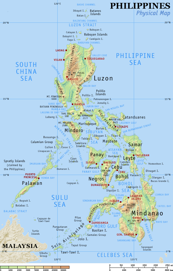
Physical map of the Philippines, showing all the major and some minor islands, bodies of water, mountains, and some major cities.
See blank version which can be used for other language Wikipedias. See also the small version.
Created and copyright (2003) by seav. Released under the GNU FDL.
Source: English Wikipedia, original upload see file history
 |
Permission is granted to copy, distribute and/or modify this document under the terms of the GNU Free Documentation License, Version 1.2 or any later version published by the Free Software Foundation; with no Invariant Sections, no Front-Cover Texts, and no Back-Cover Texts. A copy of the license is included in the section entitled "GNU Free Documentation License".
العربية | Česky | Deutsch | English | Español | Français | Italiano | 日本語 | 한국어 | Nederlands | Polski | Português | Slovenčina | Svenska | עברית +/- |
[edit] File history English Wikipedia
(del) (cur) 15:09, 29 August 2005 . . Riumplus (117068 bytes) (Removed unused colours in the PNG palette, losslessly shrinking file size by 4%)
(del) (rev) 09:09, 25 July 2004 . . Guanaco (121976 bytes) (optimize)
(del) (rev) 08:46, 17 August 2003 . . Seav (122906 bytes) (Updated map with more details)
(del) (rev) 11:13, 20 June 2003 . . Seav (130670 bytes) (Physical map of the Philippines.)
그림 고리
다음 문서들이 이 그림을 사용하고 있습니다:

