
Image:Inkeri.png
From Wikipedia, the free encyclopedia

| | This is a file from the Wikimedia Commons. The description on its description page there is shown below. |
[edit] Summary
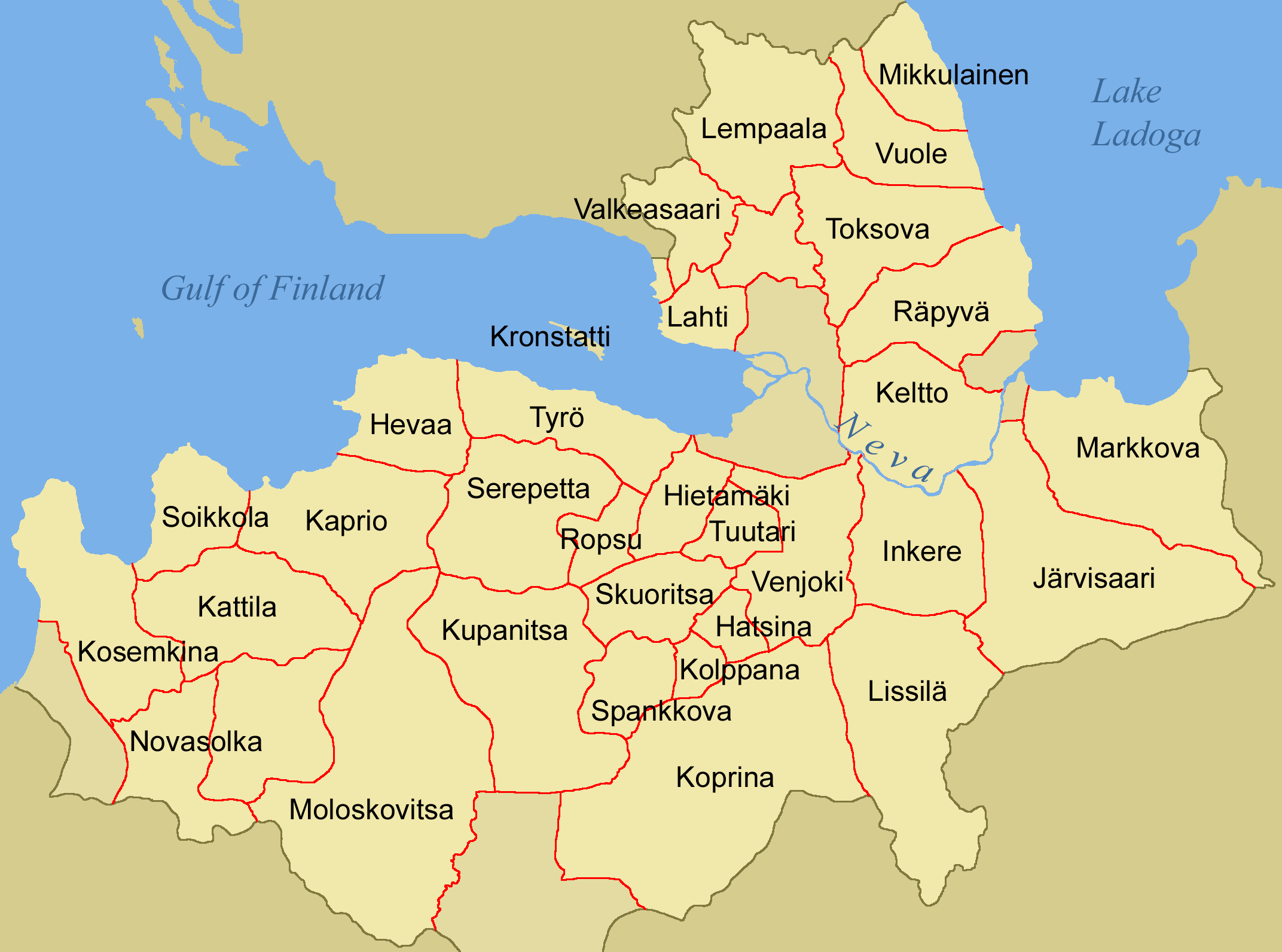
English: Map of parishes in Ingria around the year 1900.
Suomi: Inkerin pitäjien kartta noin vuodelle 1900.
Based on fi:Kuva:Inkeri3.png by IA. See Image:Inkeri4.png for the map without the titles.
[edit] Licensing
 |
Permission is granted to copy, distribute and/or modify this document under the terms of the GNU Free Documentation License, Version 1.2 or any later version published by the Free Software Foundation; with no Invariant Sections, no Front-Cover Texts, and no Back-Cover Texts. A copy of the license is included in the section entitled "GNU Free Documentation License".
العربية | Česky | Deutsch | English | Español | Français | Italiano | 日本語 | 한국어 | Nederlands | Polski | Português | Slovenčina | Svenska | עברית +/- |
File links
The following pages on the English Wikipedia link to this file (pages on other projects are not listed):

